The Canadian Rockies has been on my travel to-do list for a long time. So many people raved about the beauty and scenery, that I had to put it on my list. After my first visit to Canada, I am already planning on going back!
A little history on how Canada got to where it is today. On July 1, 1867, the Province of Canada, Nova Scotia, and New Brunswick united to form the Dominion of Canada. Western expansion led to the creation of new provinces. Canada achieved full constitutional independence from Britain in 1982.
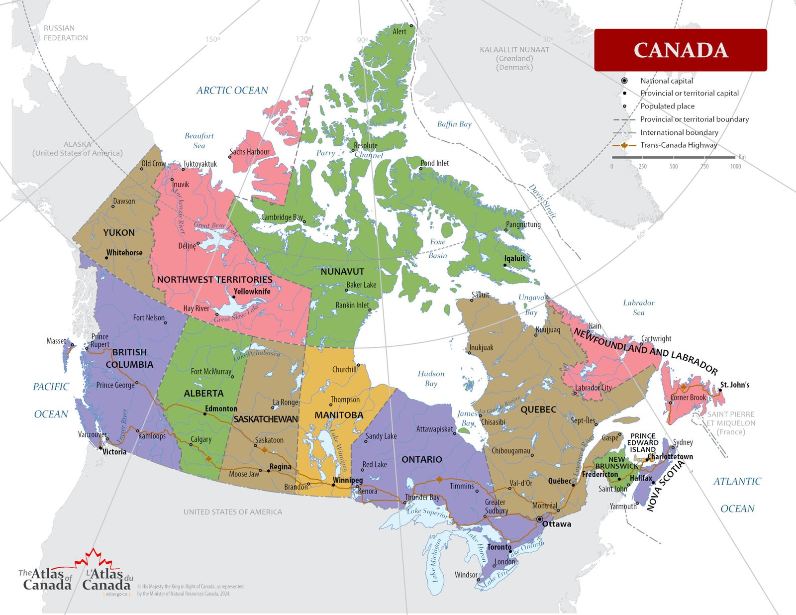
Canada is made up of 10 provinces and 3 territories.
- Provinces possess their own governments and powers derived from the Constitution Act, 1867.
- Territories are governed directly by the federal government, though they have their own legislative assemblies
My time in Canda was limited to 2 weeks and at the end of my trip, I was not ready to come home. I wanted MORE! To feel closer to nature, I traveled through Canada in my car with my RTT (Roof Top Tent). My trip started in British Columbia and then ferry/drove from Vancouver to the Canadian Rockies. I stayed in Banff, Jasper, Lake Louise, and drove (multiple times) the Icefields Parkway.
If you decide to do any driving in Canada, make sure to download the Guide Along Canadian Tours that covers where you are going to be. There were a couple of times I didn’t have anything planned for the day, so I just followed the route and stops the tour recommended. It is definitely worth it!
British Columbia
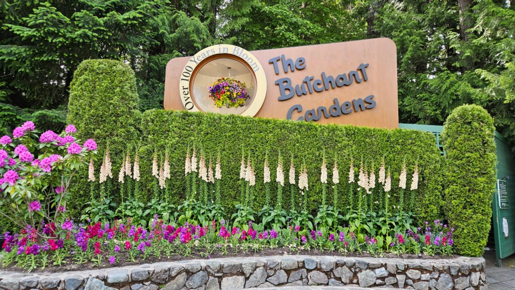
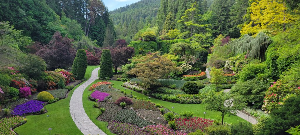
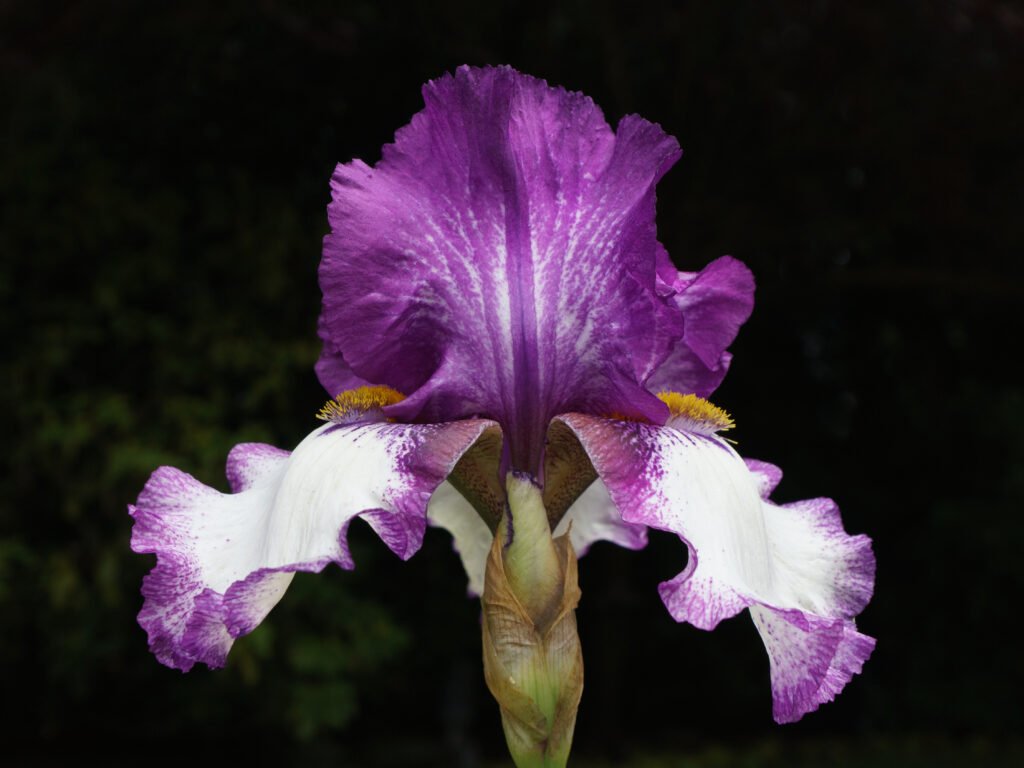
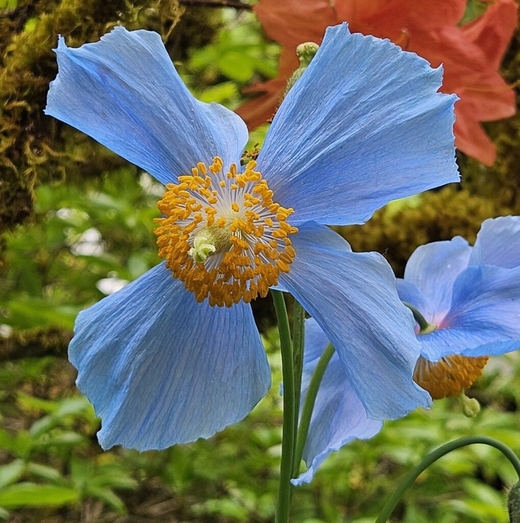
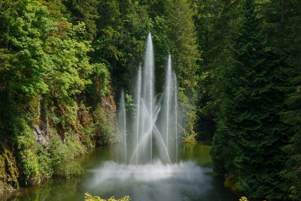
I decided to visit Victoria, BC because I have never seen Beutchart Gardens! There is really no wrong time to visit. The Gardens are impeccably maintained, and something is always blooming. For peak blooming season, the best time is in April-May.
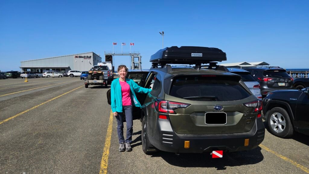
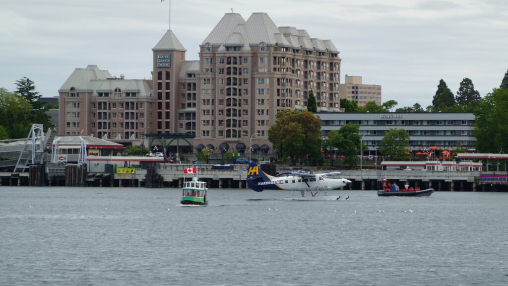
Just reaching Victoria, BC is an adventure. I purchased Ferry tickets ahead of time (recommended) so I could choose my departure and arrival time in Victoria. Since I was driving, I also had to include the length and height of my vehicle to ensure I was loaded on the correct floor and location in the Ferry.
- When traveling from the US -> Victoria Island, book ferry tickets through Black Ball Ferry Lines. I departed the US from Port Angeles and arrived in port Victoria
- When traveling from Victoria -> Vancouver, book ferry tickets through BC Ferries. I departed from Victoria (Swartz Bay) and arrived in port Vancouver (Tsawwassen).
The least stressful way to see Victoria is to park downtown and then walk. To make this easier, download and configure the Victoria Parking App ahead of time.
Recommendations
Lodging
- Airbnb – Brentwood Bay – this Airbnb was nice, though small. There is only room for 2 people and no more. It is within walking distance (a little over a mile) to Beutchart Gardens as well as some decent restaurants.
Restaurants
- Brentwood Bay Brewskys Taphouse – I ate here a couple of times. They have a variety of decent food such that Mike and I could each find something we liked.
Activities
- Beutchart Gardens
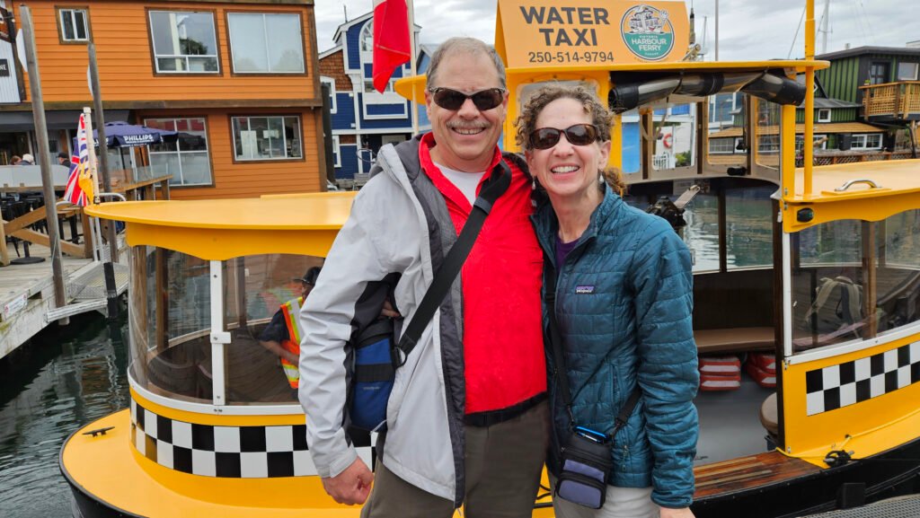
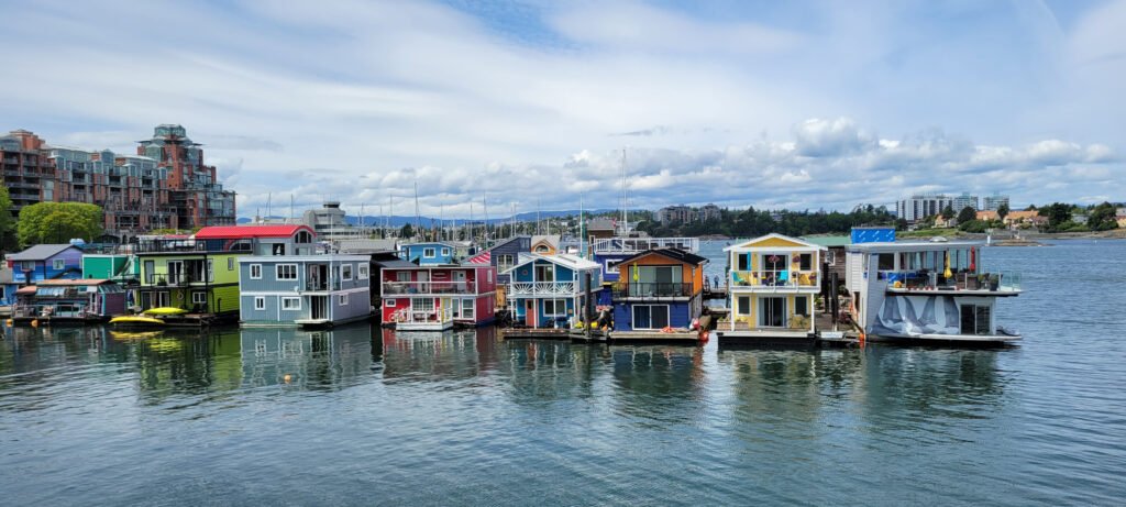
- Floating Homes in Fisherman’s Warf
- Walking around downtown Victoria – Walking Map
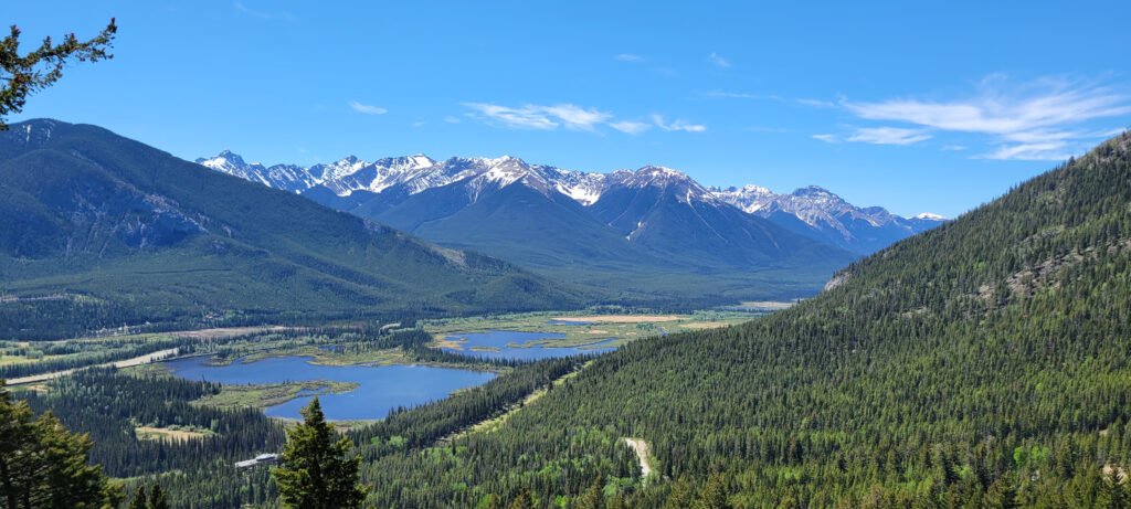
Canadian Rockies
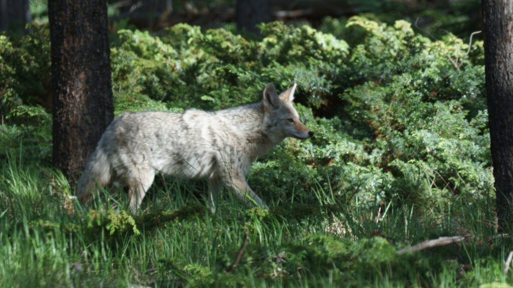
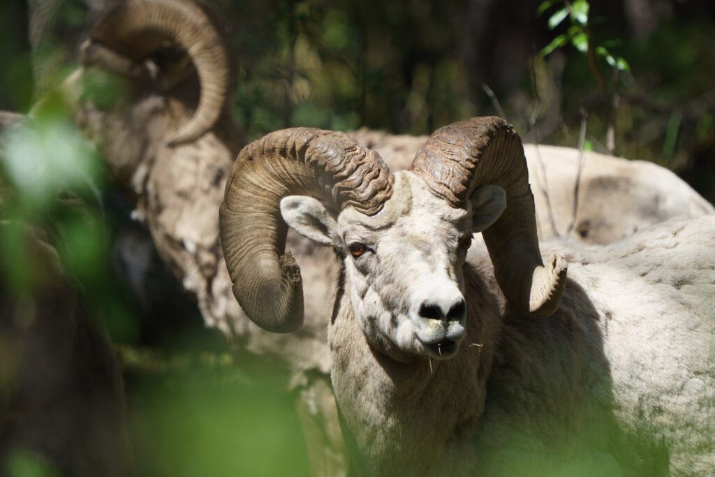
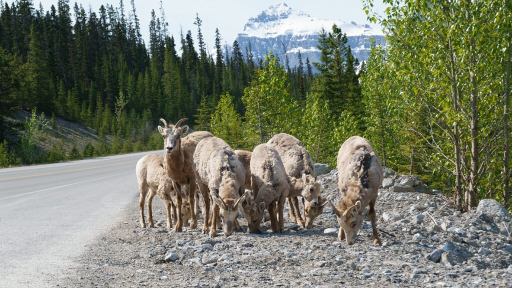
The best time to visit the Canadian Rockies is from mid-June to mid-September for hiking, kayaking, and warm weather. September to early October is ideal for fewer crowds, fall foliage , and wildlife viewing. July and August offer the best weather but are busiest
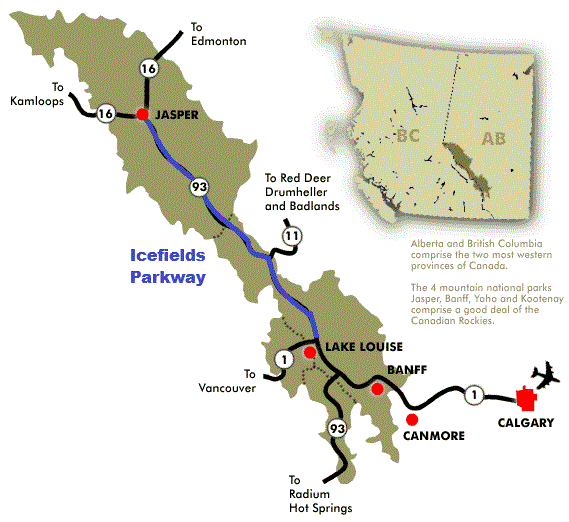
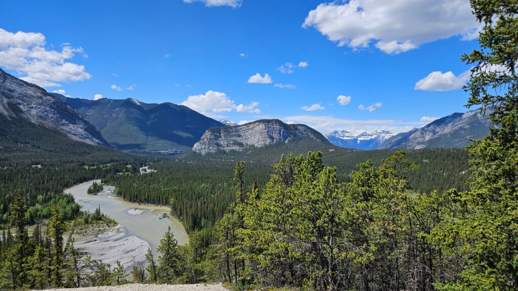
The Canadian Rockies is made up of Jasper to the North, Banff to the South, and Lake Louise just North/West of Banff. The road between Jasper and Lake Louise is the Icefields Parkway and is considered the most beautiful drive in the world.
If you are driving through the Canadian Rockies in the winter, there are very strict tire requirements. Winter tires with the 3-peaked mountain/snowflake symbol are mandatory on most Canadian Rockies highways (especially in B.C. and National Parks) from October 1 to March 31 or April 30, with a minimum tread depth of 3.5 mm. Mud and Snow (M+S) tires are legally acceptable but less effective than specialized winter tires for icy, snowy, and mountainous conditions. If your tires don’t meet the required standards, you’ll be turned away and fined, especially if you end up blocking traffic.
To make your Canadian Rockies trip more enjoyable, I recommend purchasing a Parks Canada Pass ahead of time. I purchased the Discovery because I knew I would be entering and exiting Canadian National Parks multiple times, and it was overall cheaper to go with the Discovery Pass.
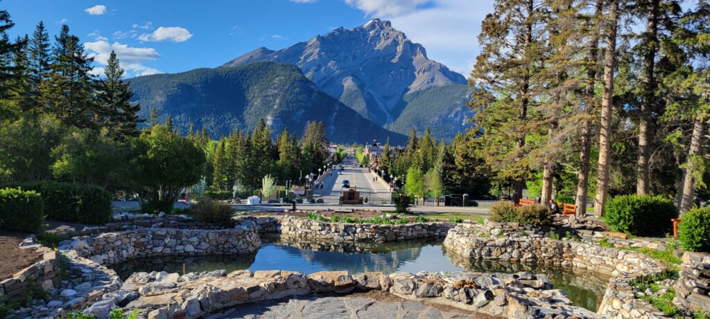
Banff
Banff National Park is Canada’s first National Park. It was established in 1885 and encompasses 6,641 Square Kilometers. The Canadian Pacific Railway was instrumental in Banff’s early years in bringing tourists to Banff after the hot springs were discovered.
When camping in Banff, I heard the trains at all hours during the day, even at night. So be prepared with ear plugs to help minimize the train whistle noise.
Recommendations
Lodging
- Camping – Tunnel Mountain Village 1. I stayed in site #H45
- As mentioned earlier, you will hear train whistles at night regardless of where you camp in Banff
- Link to Park Canada Reservation website – Enter “Banff” in the location
Activities
There are no direct links to these attractions. It is getting in your car and driving. Downloading and listening to the GuideAlong “Canadian Rockies” tour is very information and enlightening
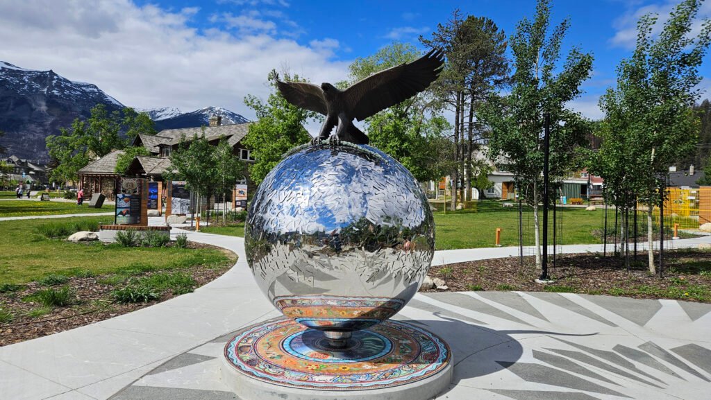
- Downtown Banff
- Walk around Banff National Park Administrative Building
- Hoodoos
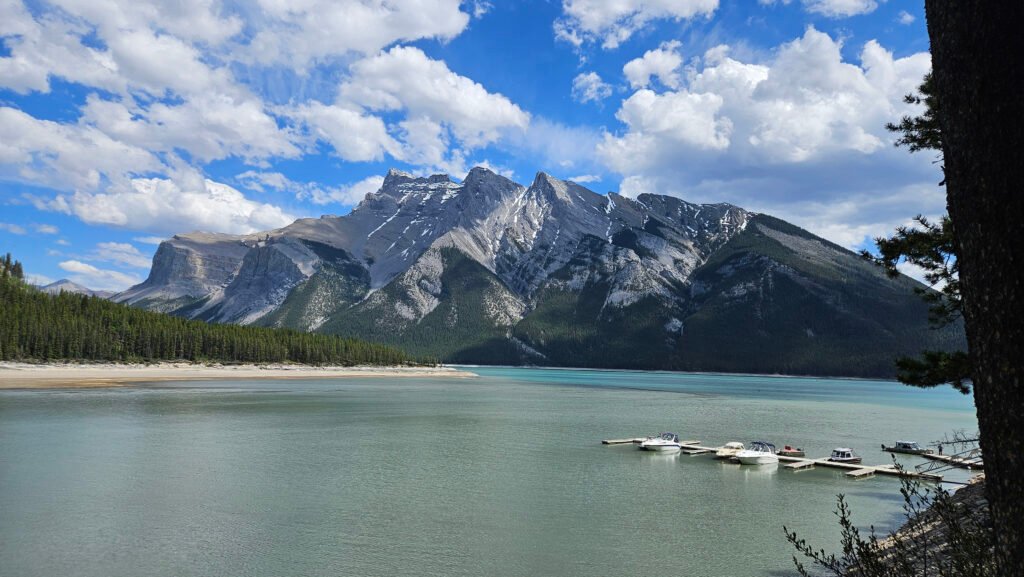
- Lake Minnewanka
- Mount Norquay
- Drive Banff Springs Golf Course
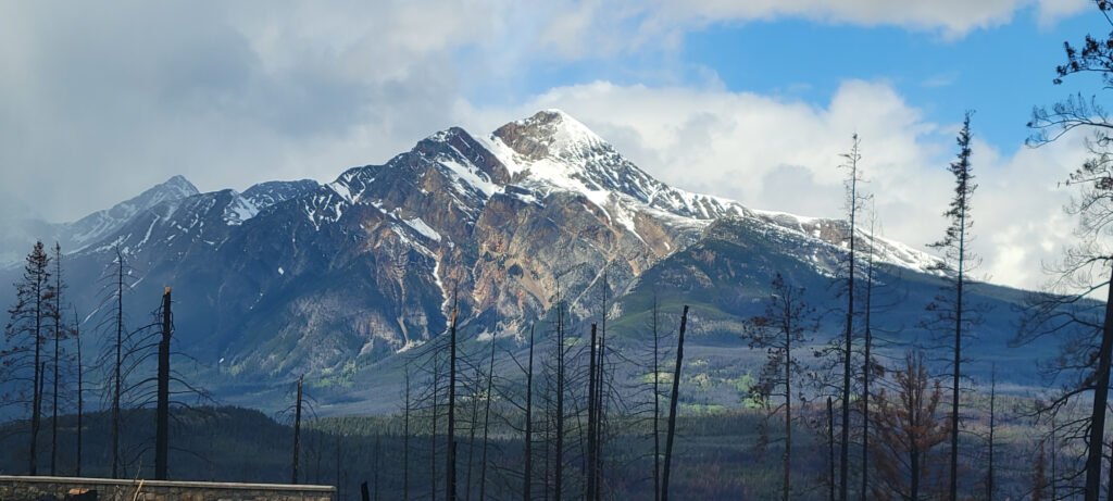
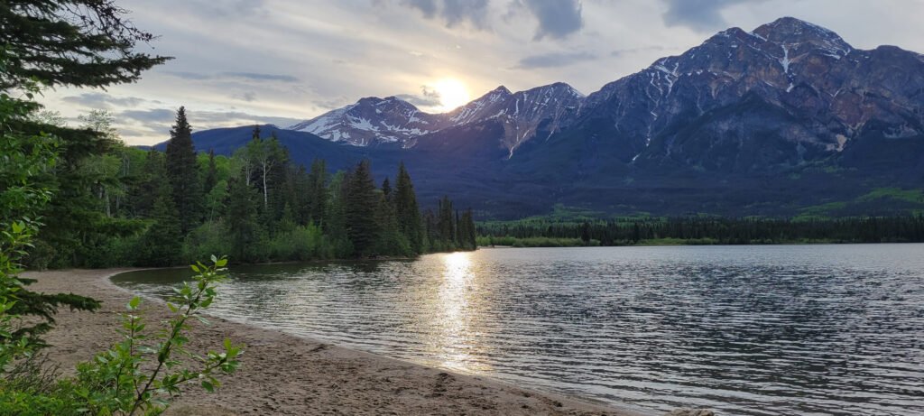
Jasper
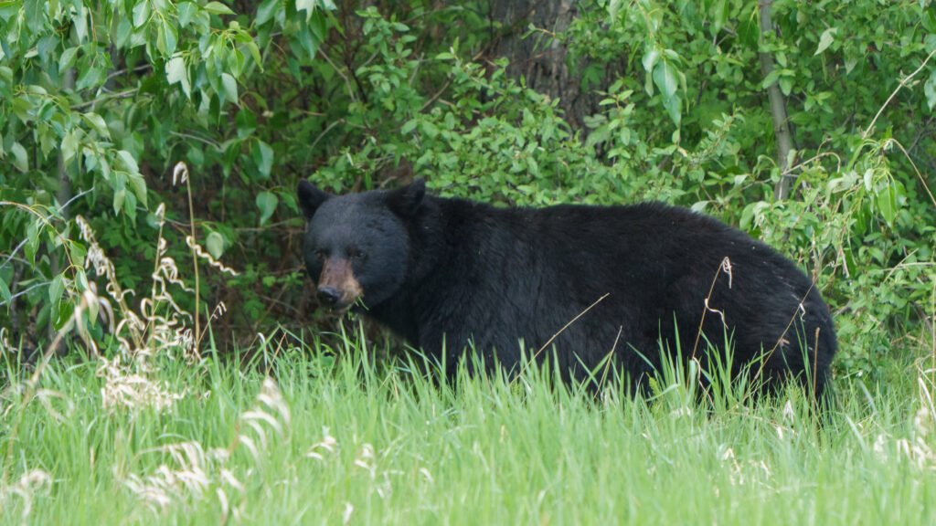
Jasper is more rustic, expansive, and closer to nature than its southern Banff and Lake Louise cousins. Jasper is also recognized as a Dark Sky Preserve, so if you are into stargazing, the Jasper area is the place to be.
Depending on what you want to see, here is a recommendation on when to visit, depending on what you want to see:
- July-August – Warm weather and everything is open.
- September – Stunning fall colors, active wildlife, and less crowds.
- Late May/June – Ideal for the fewer crowds and stunning waterfalls due to snow melt.
- March – Winter activities.
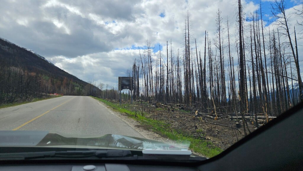
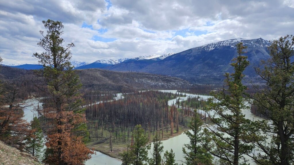
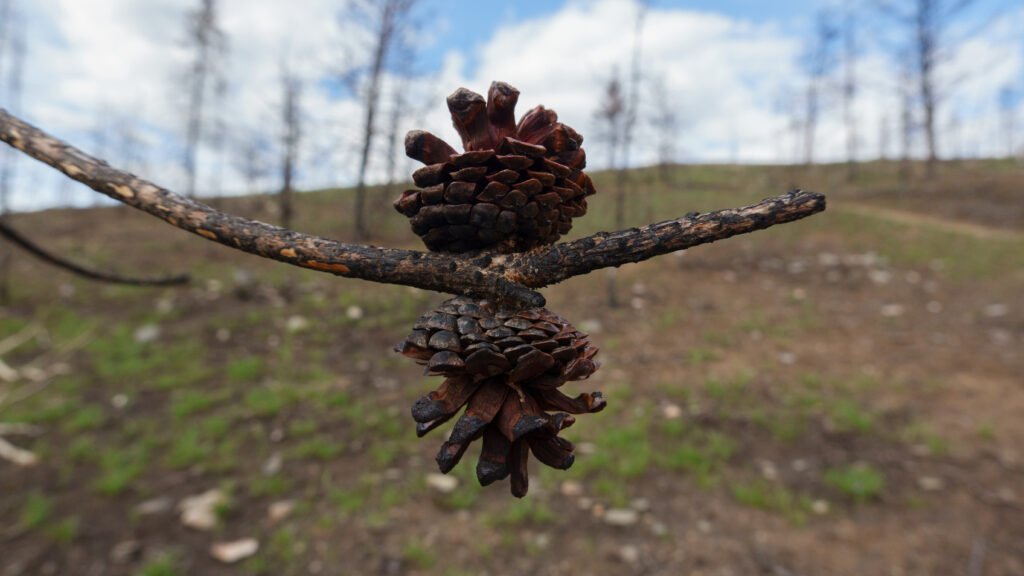
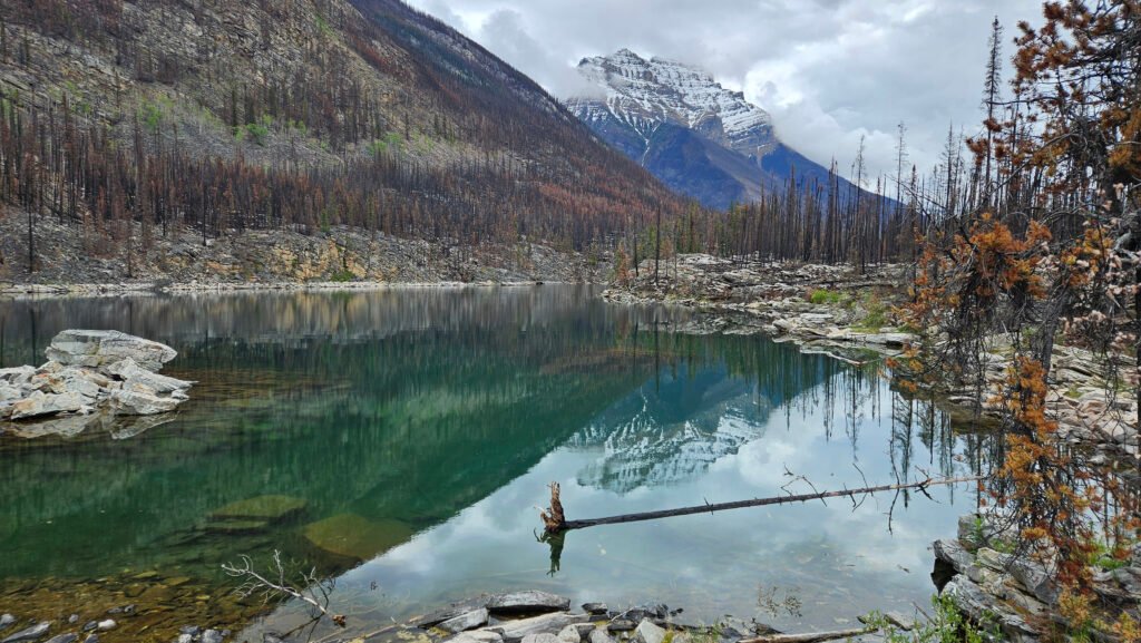
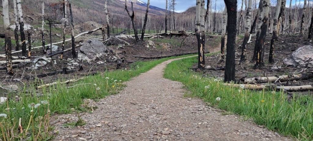
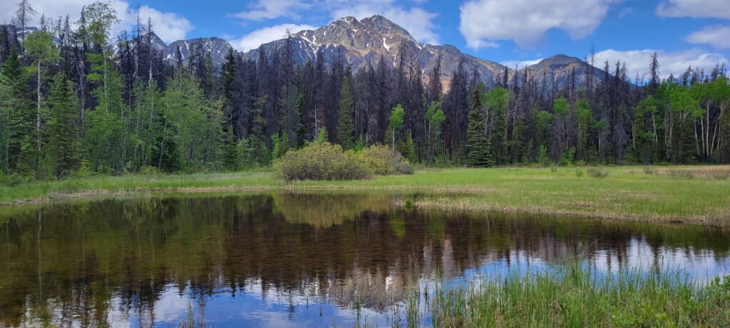
Be aware when visiting Jasper, a devastating wildfire tore through Jasper back in July, 2024. I visited less than a year later and even though there was extensive damage, I was amazed by the resilience by nature and people from Jasper. There are a lot of green shoots coming up from the ground, and the Jasper locals have kept business as well as attractions open as much as possible.
The nature and beauty around Jasper are breathtaking. Make sure to give yourself a few days to be able to wander around and explore the area.
Recommendations
Lodging
- Camping – Miette Campground. I stayed in site #D16
- Unlike Banff and Lake Louise, Jasper/Miette is not near trains, so the nights are quieter
- Link to Park Canada Reservation website – Enter “Jasper” in the location
Activities
- Downtown Jasper – I made sure to have one dinner and reloaded on groceries to help the Jasper economy.
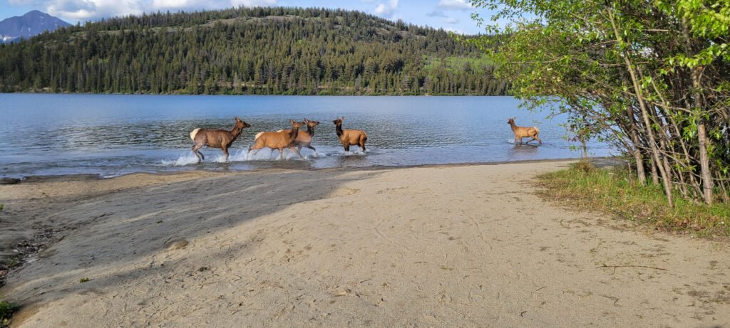
- Horseshoe Lake
- Lake Annette
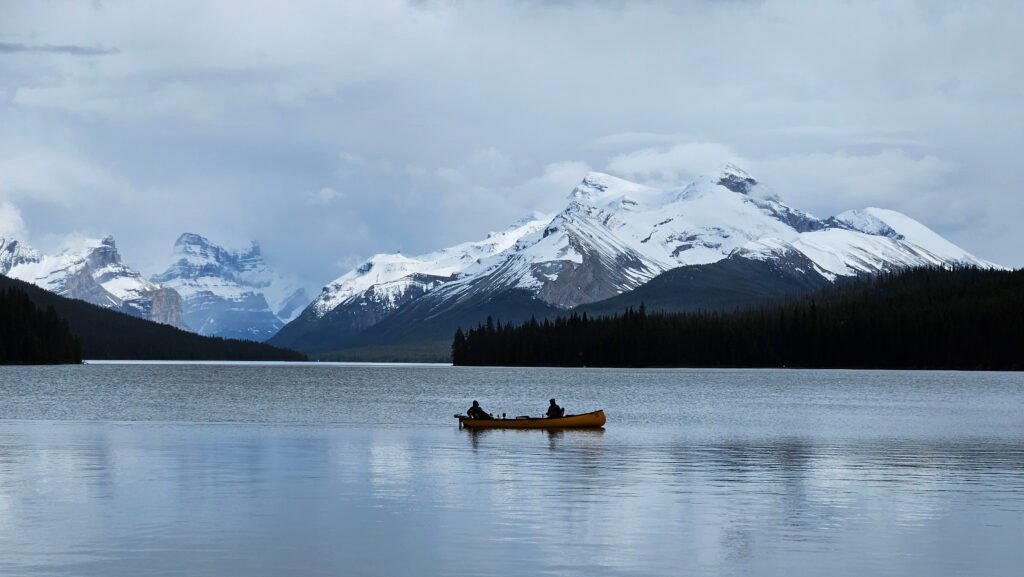
- Maligne Lake
- Medicine Lake
- Old Fort Point Trail
- Patricia Lake
- Pyramid Lake
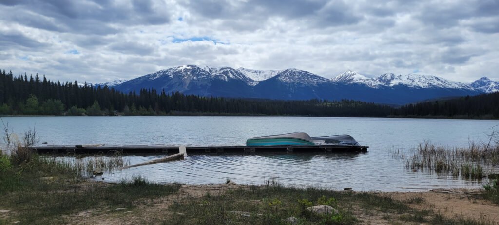
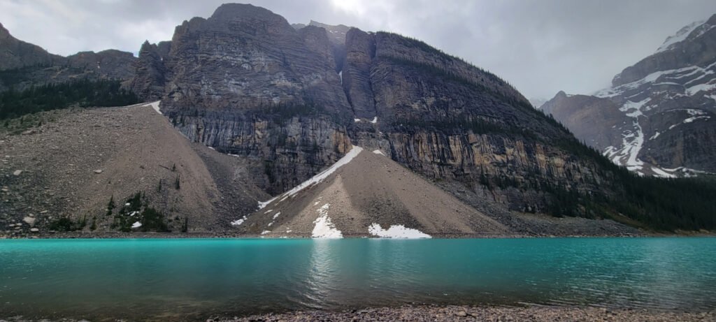
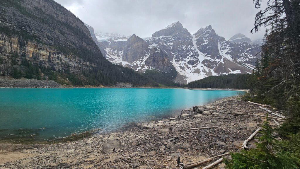
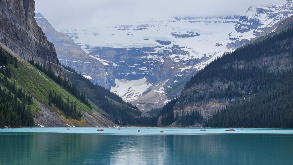
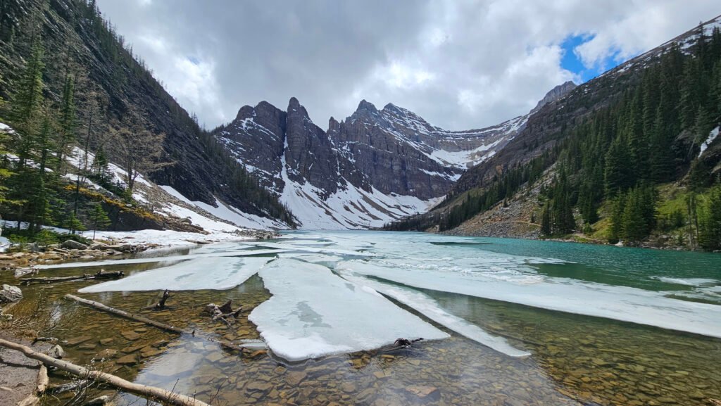
Lake Louise
To visit Lake Louise and Lake Moraine, you purchase shuttle tickets ahead of time (they sell out fast!) on the Parks Canada Reservations website. I personally found the website hard to navigate, so I went into the visitor center and there was a person there who was able to help me out. I chose to the shuttle that will visit Lake Moraine first because I figured it would be easier to pick up the shuttle to Lake Louise from there than vice-versa. Based on the crowds at the Lake Louise shuttle lot, I was really happy I went with that approach.
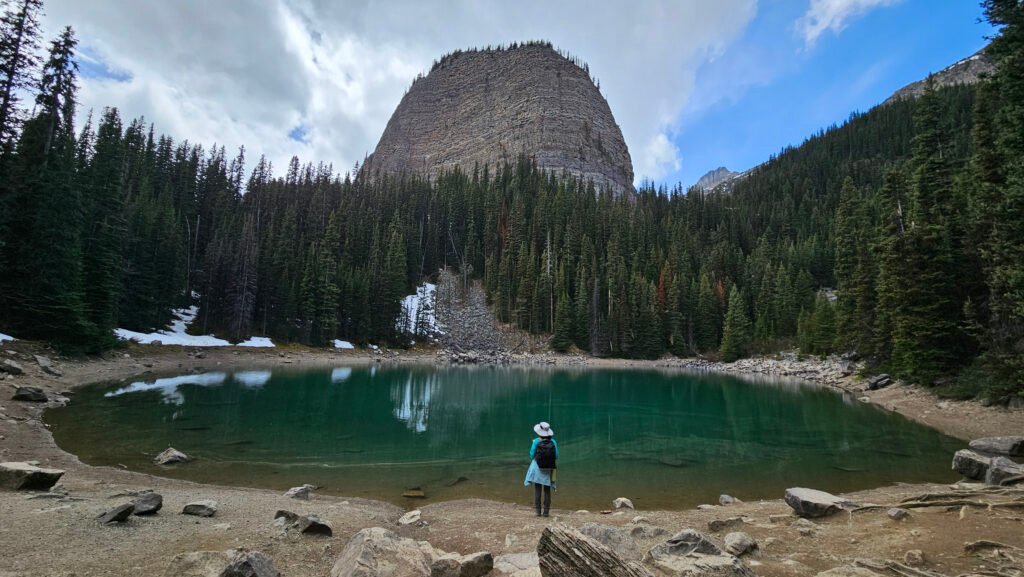
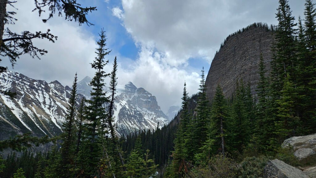
Because Lake Louise itself is crowded, I decided to take one of the hikes away from the crowds to Mirror Lake and Lake Agnes. This is a beautiful hike that gives you a view of the Beehive and the Mountains. Because of the elevation change, it was warm at Lake Louise and just above freezing at Lake Agnes. Bring layers!
Recommendations
Lodging
- Camping – Lake Louise Campground. I stayed in site #I6
- As mentioned earlier, you will hear train whistles at night regardless of where you camp in Lake Louise
- Link to Park Canada Reservation website – Enter “Banff-Lake Louise” in the location
Activities
- Lake Moraine – take the shuttle here first; it is easier to pick up the shuttle to Lake Louise.
- Lake Louise
- Mirror Lake
- Lake Agnes
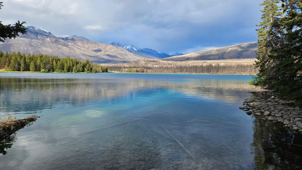
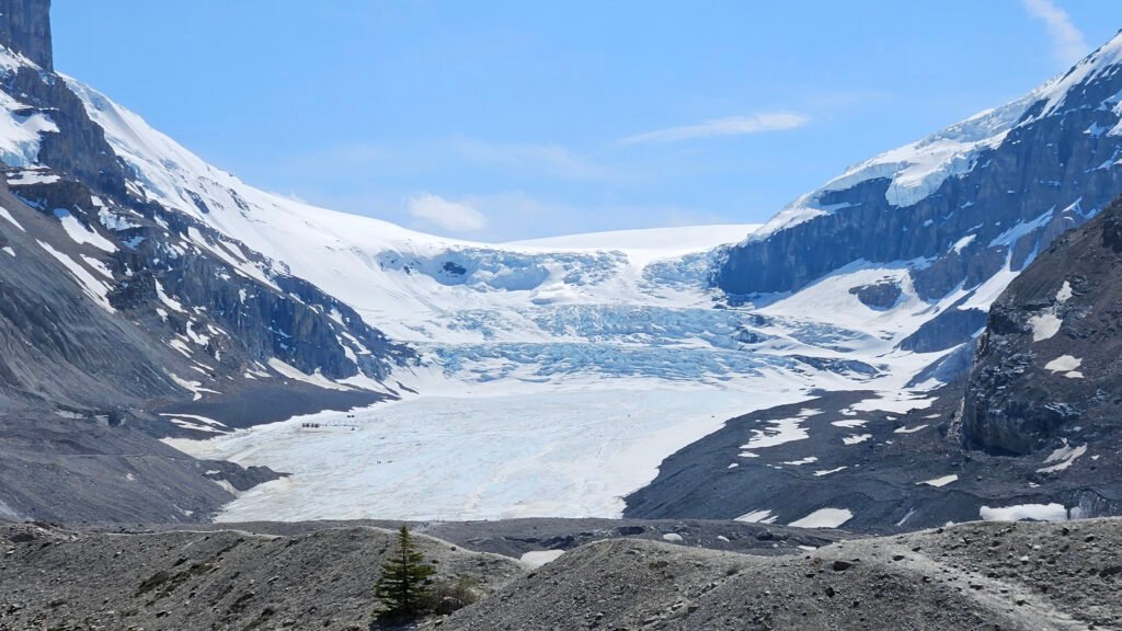
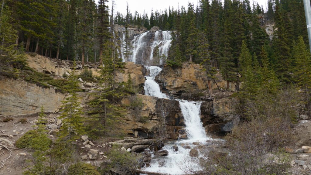
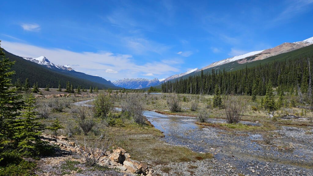
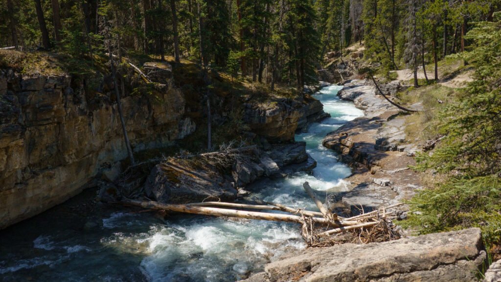
Icefields Parkway
Icefields Parkway is a 144-mile scenic drive from Lake Louise to Jasper National Park. Give yourself at least a full day to see the Icefields Parkway. Note – a Parks Canada Pass is required to drive the Icefields Parkway.
When I drove from Banff to Jasper, I left early in the morning, and I still was not able to see everything. The good news is I visited the places I missed when I drove from Jasper back to Lake Louise a few days later.
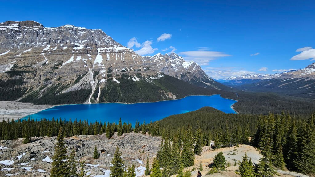
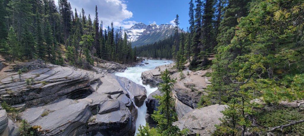
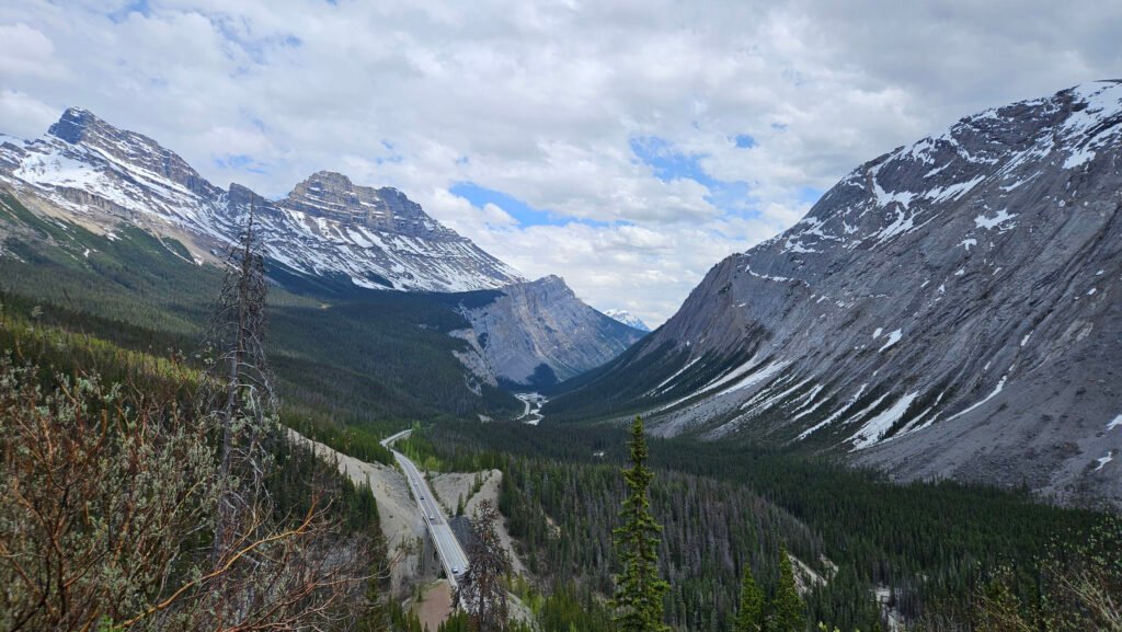
The photos below are in the order you would see them driving from Banff to Jasper.
Recommendations
Activities
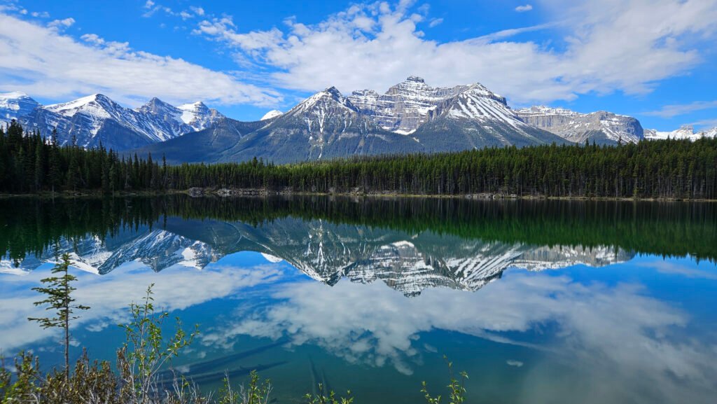
- Herbert Lake reflections
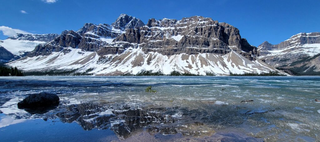
- Bow Lake
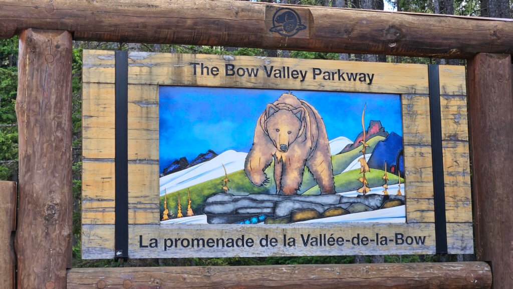
- Bow Valley Parkway
- Peyto Lake
- Mistaya Canyon and River
- View from Sunwapta Pass
- Athabasca Glacier
- Columbia Glacier
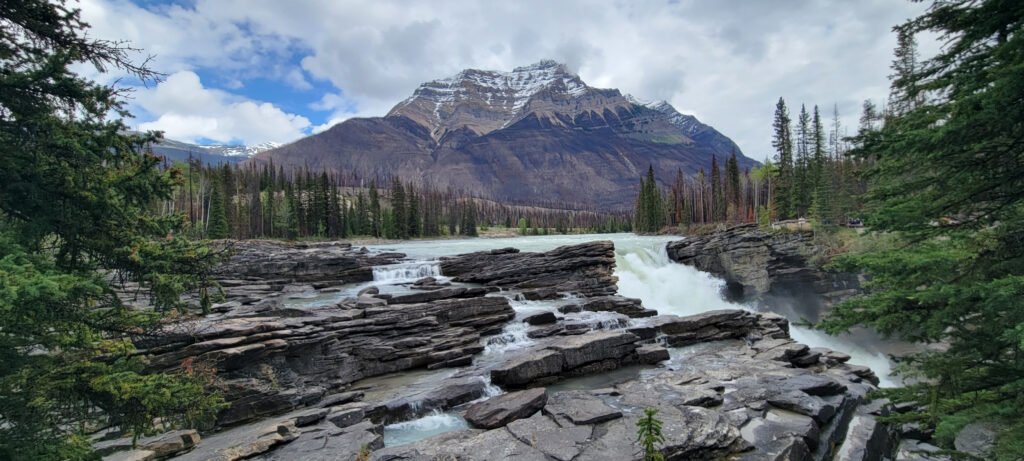
- Athabasca Falls
- Stanley Falls